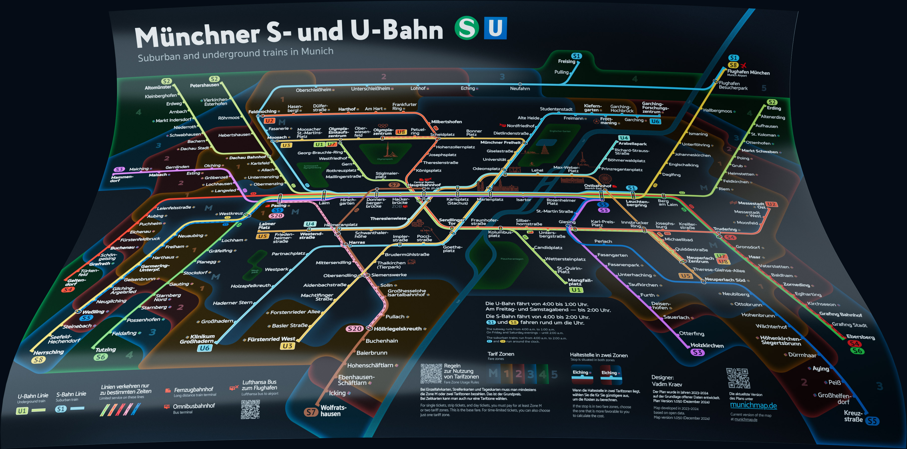
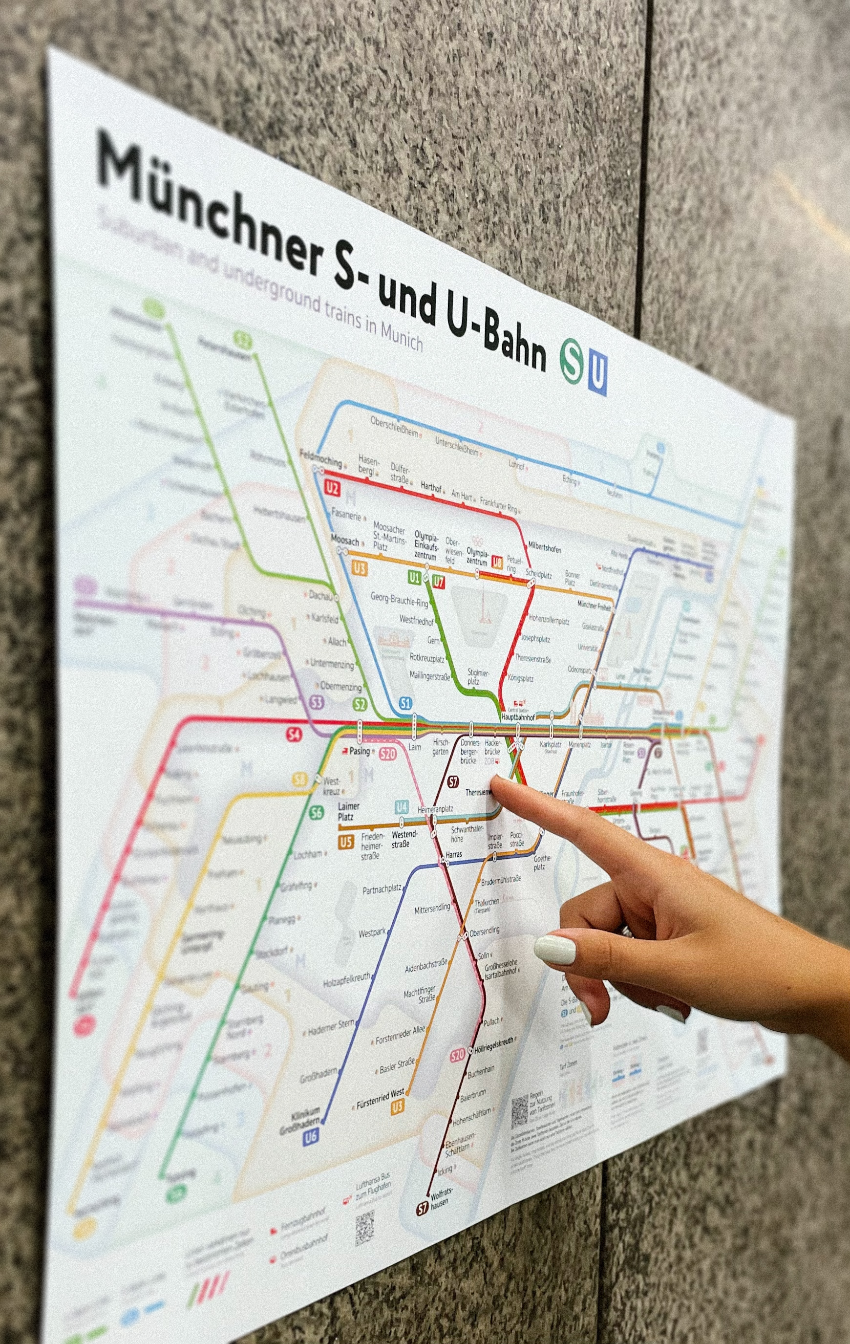
New Munich Subway Map
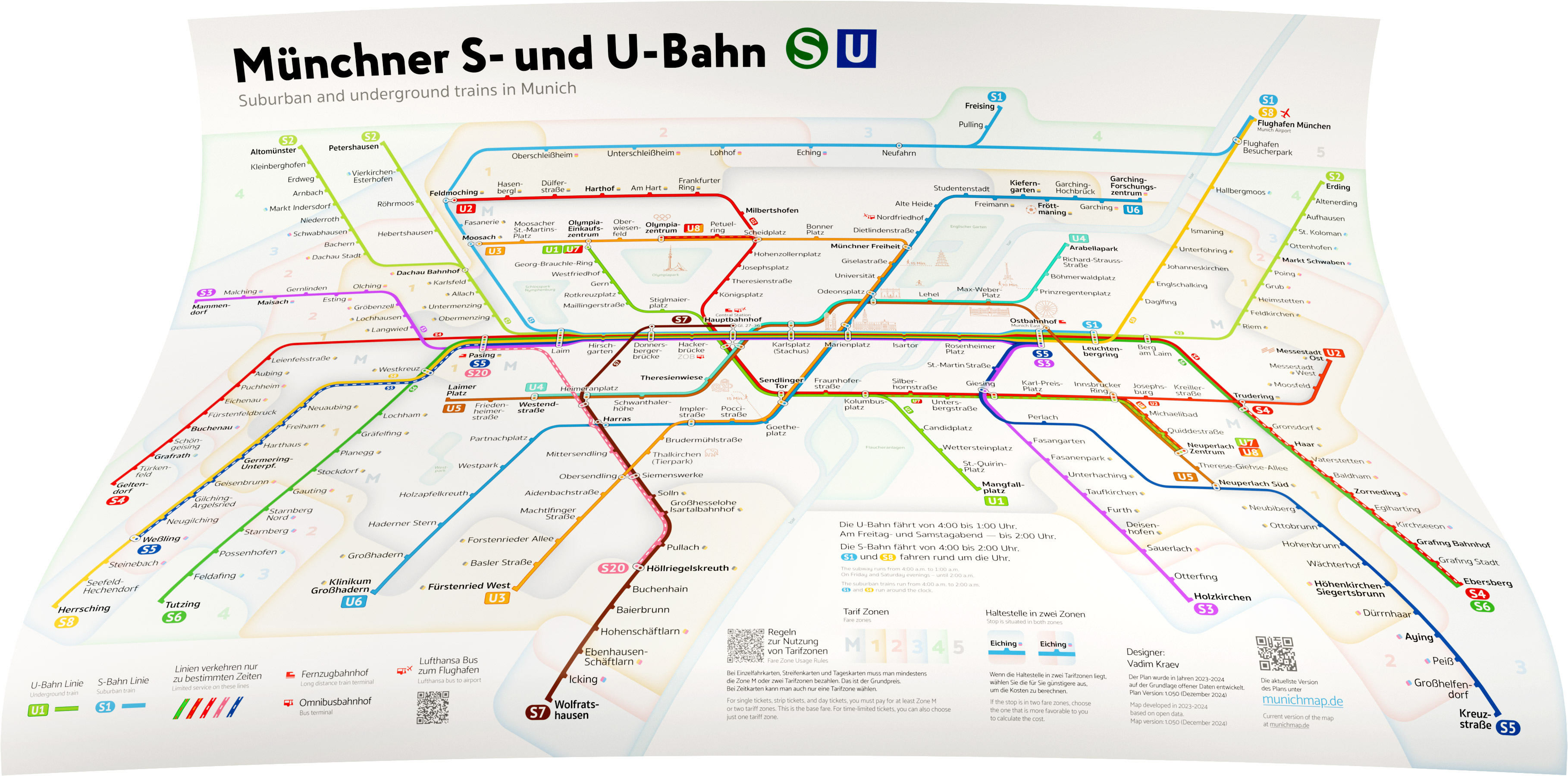
I've developed a new subway and suburban train map for Munich.
New Line Image
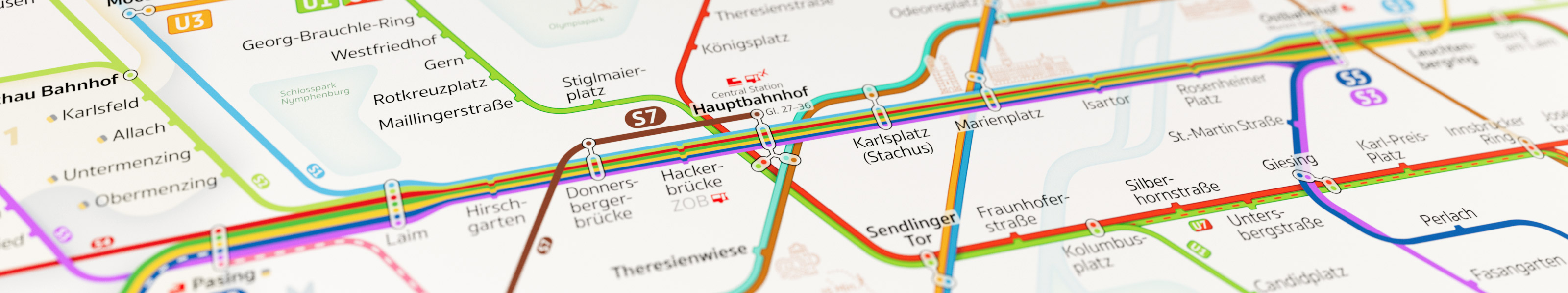
The railway tracks of the suburban trains and metro in Munich, like in many other cities, are unevenly distributed. In the city center, they are tightly intertwined, while closer to the outskirts they spread out into sparse lines diverging in different directions.
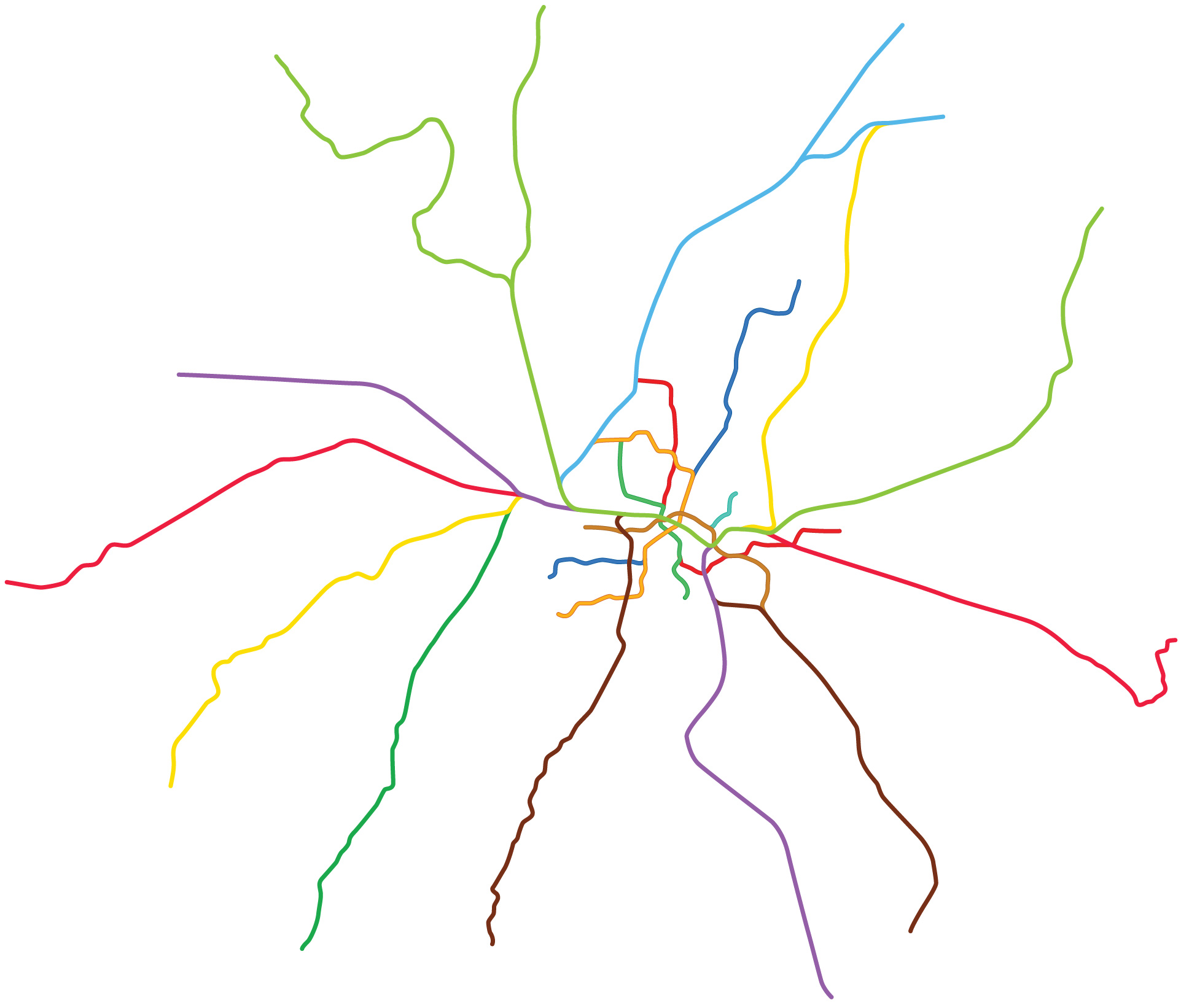
When designing transportation schemes, there's often an issue where it's challenging to lay out this lines optimally on the map. This results in overcrowded areas with dense information in some places and gaps in others.
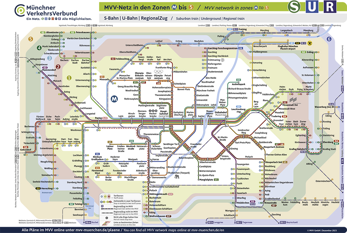
Source: mvg.de
In the new scheme, this problem was avoided — route lines are untangled, straightened, and laid out in a way that evenly distributes information on the map.
The lines on the map adhere to rules — they turn at precisely defined angles, and the distances between them are visually aligned. This brings a sense of order to the scheme.
Transportation schemes are often created using a 45° angle grid. In the new Munich metro scheme, a 60° grid is used. This reduces the number of directions lines can take from 4 to 3.
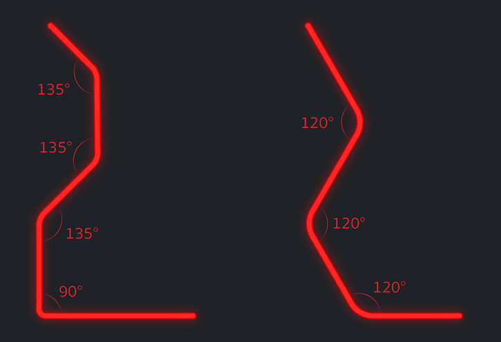
Classic 45° grid
60° grid
All of this helped reduce the number of bends by a third compared to the classic Munich scheme, making them more elegant and pleasing to the eye.
Together, the lines form a symmetrical figure, with Stammstrecke at its center.
Stammstrecke
Across Munich from west to east runs a stretch of railway tracks where all suburban train routes pass through — the "Main Line“, Stammstrecke.
Seven train lines run parallel here. Such a graphical element would have too much visual weight on the scheme and would clutter it with uniform station and transfer markings.
On the map, this stretch is condensed into a bundle, visually lightening the map without losing information.
Fare Zones
In Munich, the fare depends on the number of tariff zones crossed. On the official Munich metro map, these zones are marked with bright, muddy colors, which visually cheapens the map.
In the new scheme, the zone colors have been toned down, and their boundaries highlighted with gradients. The simplified geometry of the zones also helped eliminate unnecessary details.
A unique feature of the city is that many stations are located in two tariff zones at once. In this case, you can choose the more favorable zone when calculating the fare. For better clarity, such stations have been marked with color indicators that match the colors of their zones.
Central Station
The central station received an expressive and unique designation in the form of a fidget spinner, making it the visual center of the scheme and visible from afar, which will be useful for route planning for both tourists and city residents.

Additional Information
The scheme uses familiar markings for special stations such as Olympiazentrum, Messestadt Ost, Fröttmaning and Thalkirchen (Tierpark). Icons for these stations have been redrawn and brought into a unified style.
Railway and bus stations, as well as the airport, are indicated by special icons, as are the stations from which you can take a bus to the airport.
Since Munich attracts many tourists, I marked the main attractions of the city on the map, for which icons were created in a unified style. And since Munich is a city where Oktoberfest is held annually, the Theresienwiese meadow is marked on the map with a special symbol.
Scheme Development Process
Work on the scheme was carried out for six months in my free time and took about 300 hours.
I learned a lot during the work on the scheme, so I often went back to earlier stages of development when I realized that the scheme was not turning out as I wanted to see it.
Throughout the process, I saved intermediate versions of the scheme, so you can see how the scheme was developed from the initial sketches to the final version.
Dark Version
In addition to the main version, I also created a version of the scheme on a dark background because everything looks better on a dark background 😊

Acknowledgments
I would like to thank Constantine Konovalov, Nikita Klepach, Daniil Baev, Paul Tsupikoff, Evgeny Katyshev and Vlad Lozhkin for their advice and feedback during the development of the map.
About the Author
My name is Vadim Kraev. I’m a graphic and motion designer and have worked for many years in studios in Moscow and Munich. I’m currently based in Moscow, working as a freelancer for some of the biggest clients in Russia.
Youtube teaser
The use of the scheme is only possible for non-commercial purposes. For questions regarding licensing of the scheme and collaboration, please contact me by email.